Friday, June 20, 2014

Day Ten - La Belle France

 
French Language Students Visit Ouistreham and Sword Beach
 
Caen Celebrates Its Gratitude to the British and the Canadians


Ouistreham is a commune in the Calvados department in the Basse-Normandie region in northwestern France. Ouistreham is a small port with fishing boats, leisure craft and a ferry-harbor. It serves as the port of the city of Caen. The town is about the mouth of the Canal de Caen à la Mer. The name Ouistreham is a Viking name that comes from "Ouistre" or oyster and "ham", Viking for farm.  Hence, it was the location of Viking farms that raised oysters.  While it is today the home of beautiful sand beaches, on June 6, 1944, it was the location of "Sword Beach".
 
After their landing at Sword Beach on D-Day, the British Paratroopers and Canadian Soldiers, commanded by General Montgomerie, estimated that Caen would be liberated in three days.  In reality it took most of a month to reach Caen and flush out the remaining German defenders.  There are a multitude of reasons for this slow liberation including faulty intelligence overestimating the number of German soldiers remaining in the city and General Montgomerie's notorious cautious nature.  Nevertheless, Caenais continue to credit the British and the Canadians with the liberation of their city and they hold continue to hold British and Canadian soldiers in high esteem.

Ouistreham locks

Locks on the Caen a la Mer canal in Ouistreham. 


Transportation for British Soldiers on D Day

 
One of the many gliders that delivered British soldiers to Sword Beach
on June 6, 1944. 
 
The gliders, built by British furniture companies and the Austin Motor Company in England, were primarily made of plywood and fabric and were used  to deliver both soldiers and materiel to the war front at Sword beach.  The gliders were of two types:  The Airspeed AS.51 "Horsa" was the smaller of the two and was used primarily to deliver soldiers and their gear.  Light equipment could also be delivered using the Horsa glider. 
The larger General Aircraft "Hamilcar" was used to deliver heavier equipment including artillery, Jeeps, and other light-weight battle vehicles as well as fully equipped soldiers. 
Both varieties of gliders were towed by powered aircraft across the English Channel and released over the beach where they glided to bumpy landings sometimes causing major damage to the aircraft and leading to casualties as well.  There are only a few intact Horsa or Hamilcar gliders still existing including the well-maintained example below.


The glider on static display at the Sword Beach museum is a Horsa type.  The large white stripes visible on the wings and fuselage of this plane were painted on at the last minute before take-off so that it could be identified as an Allied aircraft by other Allied planes in the area.


 Inside the Horsa Glider
 
 
 The cockpit can be observed having very simple dual controls and instrumentation.  Seats for soldiers, seen at the bottom of the photo,  like the rest of the aircraft, were also made of plywood and were attached to the walls of the fuselage.


The Original Pegasus Bridge


Students at Universite' de Basse Normandie                                    A photographer takes shots on the original
cross the original Pegasus Bridge.                                                    bridge on static display at the museum.


The British paratroopers and soldiers had as a major objective once on the ground in Ouistreham, to preserve the bridge connecting the two sides of the Caen Canal.  Christened the "Pegasus" bridge after the British 6th paratroop unit known by that name, it had been loaded with explosives by the German troops, but in spite of great Allied losses, it was taken by the Allied troops who disarmed it and operated it.  It served to conduct troops from the beach to Caen and beyond.  The Original Pegasus bridge (AKA the Benouville Bridge) built in 1924 remained in service until 1994 when it was replaced by a new nearly identical bridge.

 
A pleasure craft transiting the New Pegasus Bridge. 
 
 
The Current "Pegasus Bridge"


 Pegasus Flying - Pegasus Bridge in the open position.


Sword Beach today in more peaceful times.

 
American students collect artifacts and test the English Channel waters with a ferry on the horizon.


Day Nine- La Belle France

La Temoignage
The Testimony
 
 
One of the last remaining members of the French Underground (Free French Fighters) during the occupation describes his role and work as a fighter for French honor and freedom.  Leader and lecturer Pierrette Bunel served as coordinator and assistant for the presentation.  


Wednesday, June 18, 2014

Day Eight - La Belle France

Oh! Canada.
 
The Students Visit Juno Beach, Scenes of the Canadian Liberation of France


An unexpected discovery of a bunker that had been buried under sand for decades appears after a high tide and a storm. 


Monument to the Canadian soldiers who helped liberate France.


Anti-tank and anti vehicle barriers that had been placed on the beach as part of the Atlantic Wall.


Ever modest, the Canadian memorial to the Canadian Naval dead.


Juno Beach Museum


Monday, June 16, 2014

Day Seven - La Belle France


We Visit Gold Beach and Etretat
Where the Mulberries "grew".
 
Of all the beaches used for the "debarquement" in Normandy, Gold Beach located near the Normand city of Arromanches, is the most often ignored.  This is a mistake.  Situated as it is between Juno Beach (arrival of the Canadian troops) and Omaha Beach (location of the American invasion and the subject of a multitude of films and print works) Gold Beach can be overlooked, but it has its own story to tell. 
Besides being one of the real successes of the invasion posting the lowest per capita casualty rate of all the beaches, was the location of the only working "Mulberry" artificial harbor.  It also is the site of  one of the most interactive of the Beach museums. 
The artificial harbor idea had its genesis within the cabinet of Prime Minister Winston Churchill prior to the invasion.  Churchill's advisors realized that lacking a real harbor in France until the Allies could liberate Cherbourg or Le Havre, the invasion would be at least slowed, and possibly stalled.  They determined that the best way to continue the re-supply and provisioning missions was to develop a series of enormous caissons lined up to create an artificial harbor.  In conjunction with old ships sunk outside the harbor, and the construction of an innovative semi-floating bridge along the caissons, the Mulberry harbor at Gold Beach allowed supply ships to dock and unload alongside the quay created by the sunk concrete boxes and to make a quick break back into the English Channel. 


View of Arromanches with the remnants of the only successful Mulberry Harbor in the distance.


Arromanches seen from the headlands above the chalk falaises behind the beaches.
 

Spare caissons to be used for repairing the Mulberry Harbor if needed.


A closer view of the Caissons on Gold Beach.


Bradley tank on static display above Gold Beach.
 
 
A FINAL THOUGHT ...
 

As a final comment about Gold Beach ... there is a fine terrace outside the museum the Gold beach landing where I was waiting for the rest of my group to exit the building following the second movie in the museum theatre.  Before they came out, a group of  French students ages 10 - 12 who were visiting the interactive museum came out onto the terrace.  After  they had all gathered there, they spontaneously broke into "La Marsaillaise" the French National Anthem.  They sang the song through to the end with a seriousness that was truly impressive.  Not only is the French Anthem every bit as challenging to sing as the Star Spangled Banner, but it has lyrics that are actually difficult to pronounce for youngsters.  They stood at attention while they sang, and it was clear that their song revealed pride in their nation and appreciation for the sacrifices of their liberators.  It was a good end to a moving visit.


After our visit to Gold Beach, we travel to ETRETAT
 
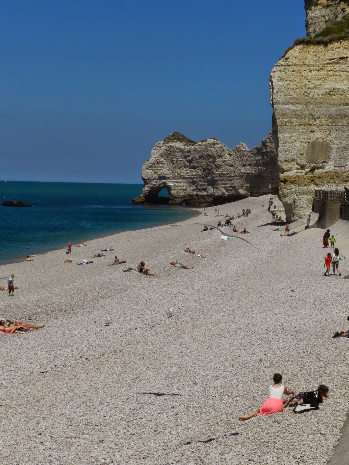
Historically, Etretat, seaside city in Haut Normandie, has been a favored resort location for Parisians due to its proximity to the City of Lights, (only a two hour drive away), due to its exceptional beauty and due to its beach made up of smooth stones, its chalk cliffs, and the beautiful views from the top.  With its many hiking paths and the relative ease of the climb, tourists can wind their way to the top of the white "falaises" and take in the amazing views without feeling that they need a Sherpa guide. 

To reach Etretat, we must cross the estuary of La Seine via the "Pont de Normandie" an enormous modern bridge that takes us from the department of Basse (or lower) Normandie to its northern neighbor, Haute (or upper) Normandie, on the other side of the Seine River.  While both parts are part of the traditional Normandy, they have been separate administrative districts for many years. 
 
 
The Pont de Normandie


Etretat:
Careful examination of this photo reveals the outlines of hikers who have reached the top of the cliffs at Etretat. 


The beautiful and immaculate stone beach at Etretat.  There is an excellent board walk behind me.  Far from being like the Jersey shore, there are restaurants,  ice cream sellers, and fine hotels along the famous walkway. 


A view of the arch from the top.  But, we are not yet all the way at the top of the cliffs.


Calm seas with gentle breezes on the day of our visit to Etretat encouraged sailors to go for the "Blue Water", what the French call taking to "le grand large".   

 
A view of the beach on the way up to the top with the chapel on the top of the cliffs at the other end of the beach.


Whew! We have reached the top of the climb. Two much younger students who accompanied us to the top. 
 

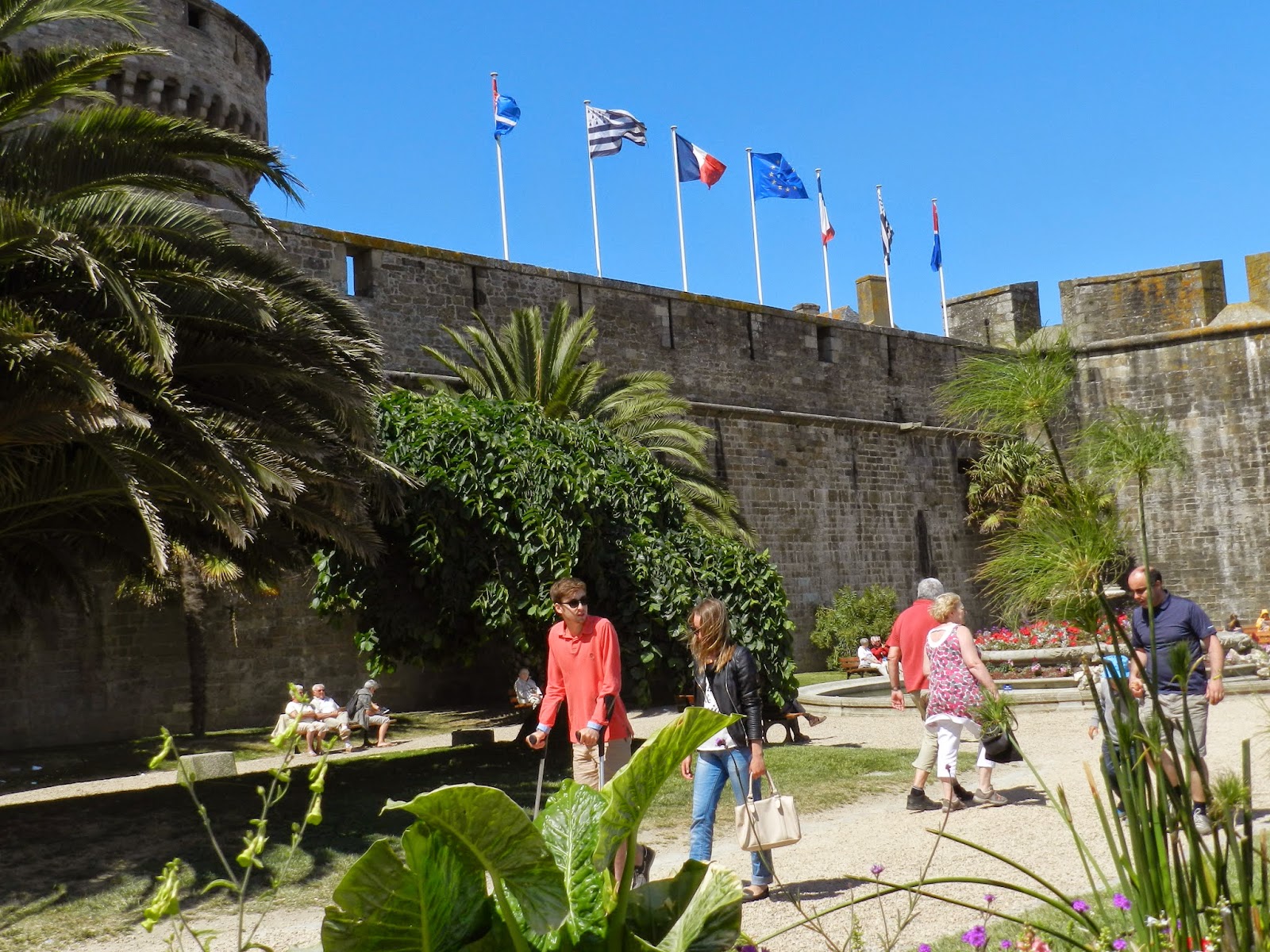
The ramparts of the city of Etretat.


Sunday, June 15, 2014

Day Six - La Belle France

Mont Saint Michel is in Normandy
....  not in Brittany
 
We Visit one of the Great Wonders of The World ...


Originally called "Mont Tombe" by the ancient inhabitants of Normandy, there has always been an island here ...  a "small rock" in the Atlantic with a perimeter of only about 900 meters and rising about 80 meters above the sea.  Seated at the mouth of the Couesnon River which runs roughly north west and  forms the boundary between Normandy and Brittany, Mont St. Michel has been the object of an ongoing and (somewhat )"friendly debate "as to whom it belongs.  Because the island is east of the mouth of the Couesnon, Normandy has traditionally claimed it.  However, this does not stop Brittany from occasionally making the argument that the river is capricious and has occasionally shifted directions in the past placing it, however briefly, in the hands of the Bretons. They also occasionally remind Normands that it was given to Brittany for a brief period in the Middle Ages. 

  But ... the church is a relatively "recent" addition to the solid granite outcropping.  According to the traditional Normand legend, the church itself only exists because of the influence of St. Michael the Archangel himself.
 
 
The Legend:
 
In the year 708, Aubert, the Bishop of Avranches received a vision during his sleep.  The vision was St. Michael the Archangel who appealed to Aubert to build him an oratory (a small chapel) on the island of Mont Tombe.  Aubert, being the humble and pious man he was, quickly replied that he would do so.  But, upon waking the next morning, Aubert became immersed in his many duties and responsibilities and over time, simply forgot that he had made the promise to St. Michael. 
Some time later, St. Michael again appeared to Aubert as he slept.  St. Michael asked where his Oratory was.  The good Aubert replied that he had not built it.  St. Michael again requested that Aubert make the building of the Oratory a priority.  However, once again, upon rising, Aubert quickly forgot the promise he had made. 

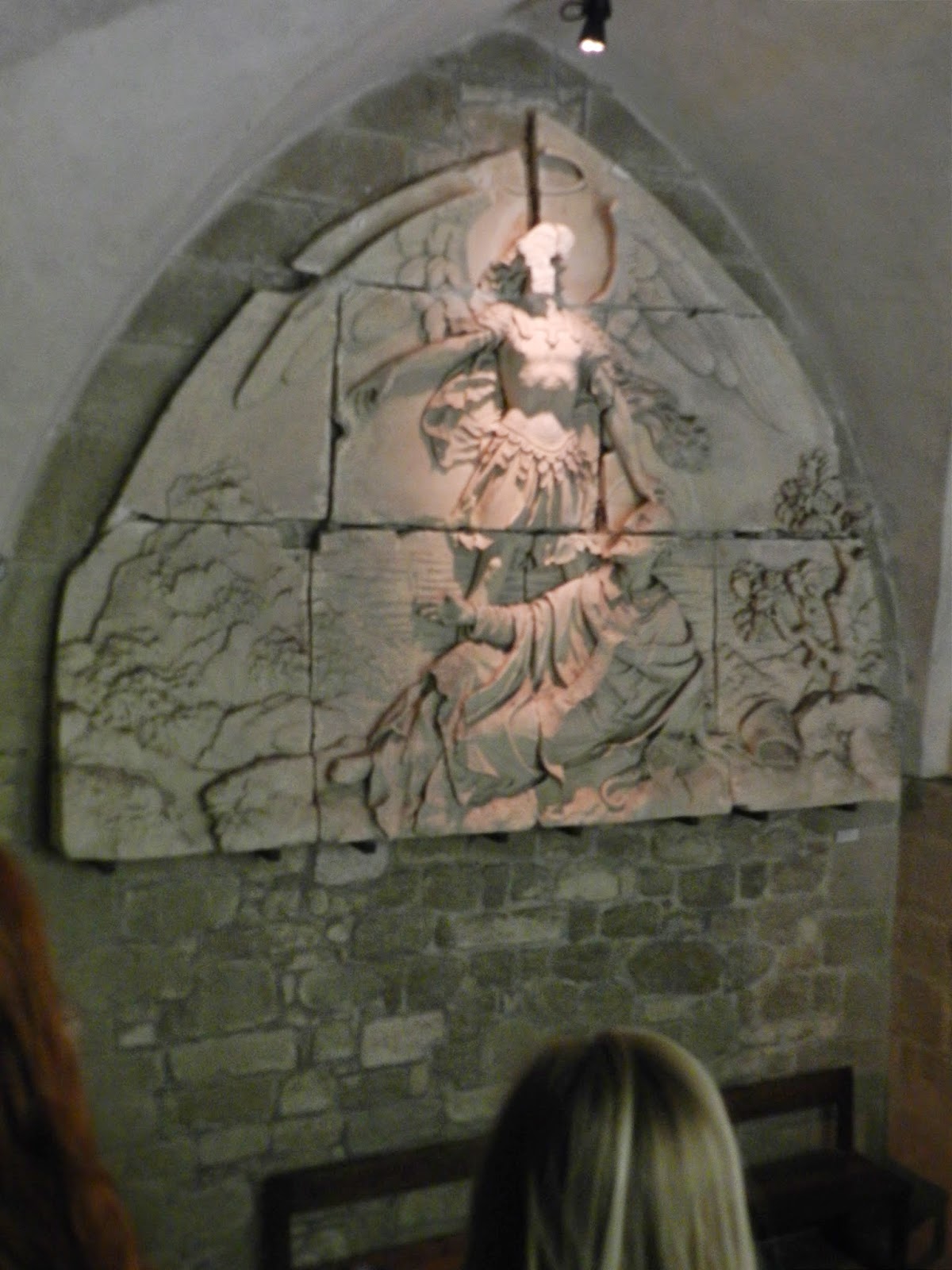
On a third occasion, St. Michael appeared to Aubert.  This time, in order to persuade the Bishop to remember the promise he had made, St. Michael pressed his finger to the forehead of Aubert resulting  in a depression in the forehead of the Bishop which others around the him immediately noticed the following morning. 

Realizing that the Saint was serious about his request, this time, Aubert immediately set about having the small oratory built on the hill of Mont Tombe.  The oratory was dedicated in the year 709.  When he died, in 720, Aubert's skull was examined and was found to have a prominent depression (some say a hole) in the center of his forehead.   His skull is enshrined as a genuine relic in the Basilica of Saint Gervais in Avranches.

 
A medieval high relief stone carving illustrating Bishop Aubert and St. Michael the Archangel.

 
Over the years, the island gradually became home to a larger and larger religious community which required additions to be made made to the church until finally La Merveille (the marvel) was completed.  Reflecting traditional medieval social structure, the top of the island is devoted to God, the next level below it dedicated to the administration of the Church, the level below that reserved for stores, and the lowest levels reserved for residents and merchants with the lowest level used for the homes of humble fishermen and their families. 
 
In addition to being a religious site and home to an order of Cistercian monks, the site has been used as a prison and a fortress over time.  Currently there are only a very few monks residing at the abbey.
 
The Approach to the Island:  Traditionally, since the 1800s, there has been a road connecting the island and the main land.  Over the years, this road has caused extensive silting around the island and threatened to cause the island to become more of a peninsula rather than an island.  Additionally this increase in silting was causing major changes in the eco-system.  A new bridge-style connection with an increased parking area on the mainland was launched in 2005.  The project includes a new dam and ecological improvements on the Couesnon River and its banks.
 
 
The weather started out Normand Style, but improved during our visit.
 

The Commercial area of the island.


The bridge where monks could go from their cells to the church without being disturbed or seen.  Students in the French Language Acquisition program.


French language and culture students listen to an overview of the next level of their climb.

 
The entire complex is built of local blocks of granite quarried on another island and brought to Mont St. Michel.  Medieval stone masons' marks may still be seen on individual blocks of stones.  Granite is the only stone that can withstand the weather and seawater. 


The entrance to the church referred to as La Merveille


Inside La Merveille during Mass.

 
Arches at the top of Mont St. Michel


The cloister at the top of Mont St. Michel


The refectory at Mont St. Michel with students listening to a tour guide.


The scriptorium at Mont St. Michel.  The medieval tasks of copying and creating print art were neither as easy nor as pleasant as one might have thought.


The view from the top.
 

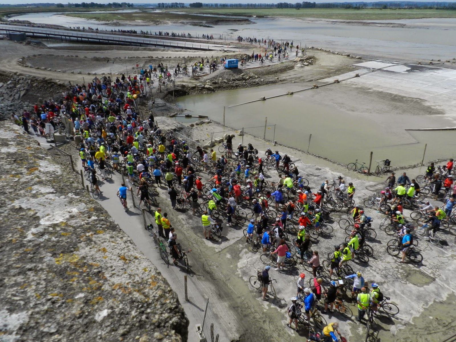
A national bicycle race beginning at the foot of Mont St. Michel.